
AVL SYSTEMS / TELEMATICS FOR BUSINESS
Your vehicles.
The complete picture.
GPS tracking and fuel monitoring for data-driven decisions.

CORPORATE SERVICES / OPERATING IN WARTIME
Tougher conditions.
Higher demands on monitoring.

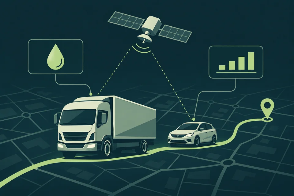
In wartime, corporate fleets face greater risks than in peacetime. Tracking vehicles, detecting dangerous events promptly and having reliable information help dispatchers and managers make decisions.
AVL Systems has solutions ready.
We combine equipment, mobile connectivity and Wialon capabilities to suit your routes and operating conditions. We configure monitoring to meet your business's increased requirements.
DEVELOPED BY AVL SYSTEMS
Vehicle positioning
under electronic interference.
Our company has developed a GPS monitoring system capable of displaying a vehicle's position while it is affected by electronic warfare equipment.
We select solutions for the vehicle and its operating environment. Position display capabilities and accuracy depend on the equipment configuration and the nature of the radio interference.
MONITORING DURING BLACKOUTS / STARLINK DIRECT TO CELL
When the power is out —
stay connected to your vehicles.
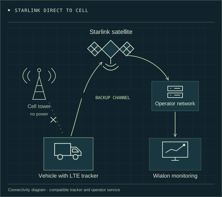
Mobile connectivity may disappear during blackouts. Cell towers lose power → the terrestrial network becomes unavailable → conventional trackers stop transmitting current data.
- The fleet disappears from live monitoring.
- Current routes are no longer visible.
- Telematics data no longer reaches the dispatcher.
- Day-to-day vehicle monitoring becomes more difficult.
A GPS tracker that transmits data via Starlink
In an AVL Systems configuration, a compatible Ruptela Eco5 tracker can use Starlink Direct to Cell as an additional communication channel. The satellite connects to the tracker using cellular technology, without a separate Starlink dish on the vehicle.
When local towers are off or terrestrial coverage is unavailable, the satellite channel may support data transmission. The terrestrial 4G network takes priority. Direct to Cell availability, SIM compatibility and settings are checked for each project.
Why it matters now
Fleet monitoring during blackouts
An additional data channel helps dispatchers maintain vehicle oversight when terrestrial mobile connectivity is unavailable.
Routes beyond terrestrial coverage
Satellite connectivity can supplement monitoring in fields, on highways, in quarries and in mountainous areas, provided satellite reception conditions are suitable.
Less dependence on local cell towers
You do not have to rely solely on the nearest base station. Direct to Cell requires compatible equipment, a SIM card and access to the operator's service.
Telematics for operational decisions
Additional transmission of coordinates and metrics matters for logistics, security, agriculture and special-purpose machinery. Update frequency and possible delays depend on the available communication channel.
An example of this solution — Ruptela Eco5
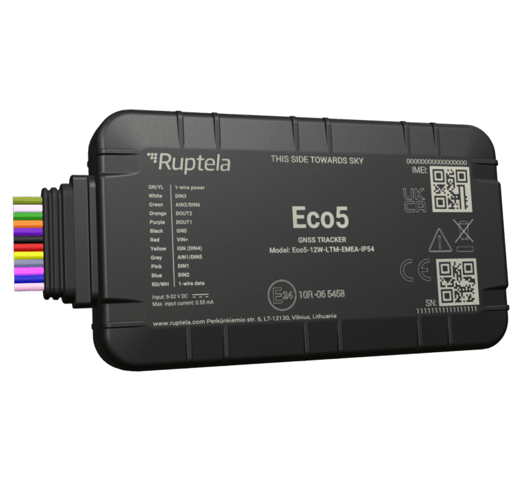
AVL Systems conducted three-month trials of the Ruptela Eco5-5W-LTE-EMEA-IP54 and the standalone Asset 5-LTE-EMEA beacon. Our experience with Starlink Direct to Cell is described in Kyivstar Business Hub.
We will select the right Eco5 variant and connectivity configuration for your fleet. Compatibility of the specific model is confirmed before ordering.
A modern fleet needs an additional communication channel rather than relying only on local towers being restored. Discuss your routes and monitoring needs with AVL Systems, and we will propose a suitable configuration.
Positioning and data transmission are separate system functions. Starlink Direct to Cell provides connectivity; positioning under electronic interference depends on the positioning solution and the radio environment.
4G and international operation
We select 4G trackers with roaming connectivity for international routes, checking the device variant, operator and countries of operation.
SIM cards for demanding conditions
We offer industrial SIM cards designed for temperature extremes, vibration and other demanding vehicle operating conditions.
Monitoring hazardous areas
We configure geofences and alerts for entry into restricted or hazardous areas defined by you. Dispatchers receive the information they need to respond.
Towing and jamming attempts
Where supported by the equipment, we configure towing events and detection of possible jamming attempts. This helps identify unusual vehicle situations.
Driver behaviour
We analyse driving style to identify risky behaviour, improve driving discipline and reduce unnecessary fleet costs.
Routes tailored to your business
We use route planning and execution monitoring tools to help dispatchers track movement, stops and deviations from agreed plans.
Data for managers
We configure reports and vehicle usage overviews. Mileage, vehicle activity and costs help assess fleet performance.
Planning maintenance
We organise cost tracking and maintenance planning so your team can identify vehicle needs and prepare servicing in good time.
Available features depend on the tracker, connected sensors and configuration. Data transmission depends on mobile coverage, and satellite positioning may be disrupted by radio interference. We agree the configuration and alert scenarios to suit your operating conditions.
FROM A POINT ON THE MAP TO A CLEAR PICTURE
Fewer unknowns.
More control.
Where is the vehicle? What is happening with fuel? How did the shift go? Bring the information you need into one workspace.
VIDEO / AVL SYSTEMS
Vehicle monitoring.
Get to know us.
A short introduction to AVL Systems — GPS vehicle tracking and solutions for your fleet.
1 min 22 sec · Introduction
GPS vehicle tracking by AVL Systems
FLEETS OF 20 OR MORE VEHICLES
Trackers — free of charge.
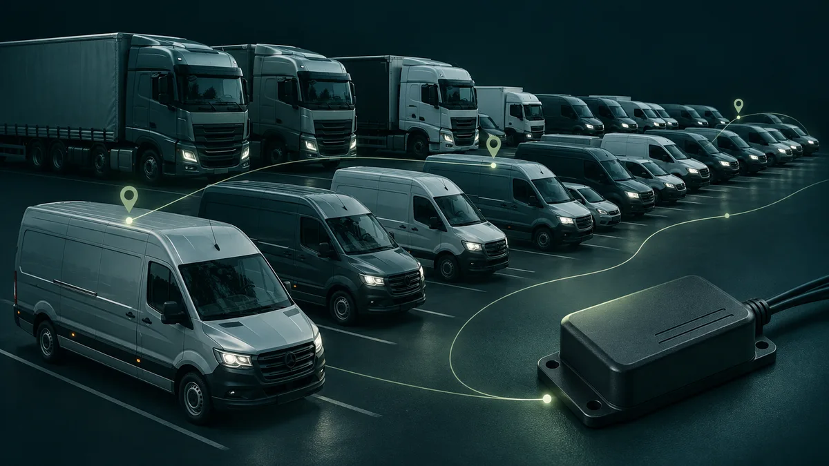
For fleets of 20 or more vehicles, trackers are supplied free of charge when a full year's subscription is paid in advance.
Subscription fees, equipment and installation are agreed in an individual quotation.
OFFERS / SPECIAL TERMS FROM AVL SYSTEMS
Two packages.
One great price.
For hauliers, delivery services, rental companies and corporate fleets. Choose fuel monitoring or passenger car CAN-bus data reading.
Time to decide
The countdown has ended. Please check with AVL Systems whether the offer is still available.
FUEL MONITORING
Fuel level monitoring
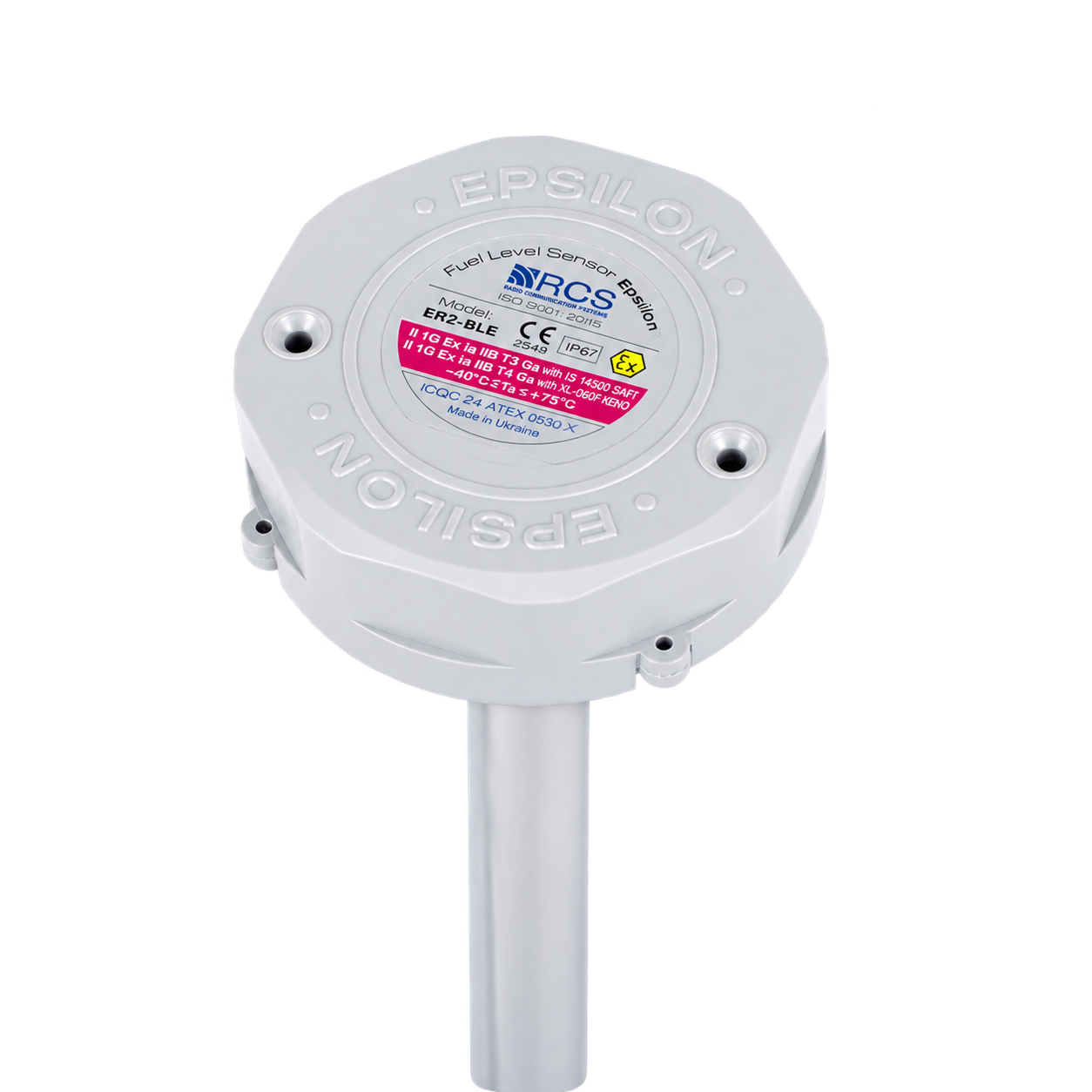
Ruptela Eco5 + RCS fuel level sensor
Monitor your fleet's fuel level, refuelling and consumption.
5 000 UAH incl. VAT
Installation is not included
Extended package warranty
CAN-BUS DATA
Passenger car CAN data
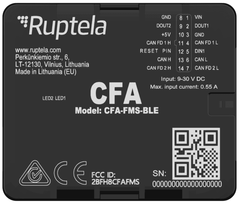
Ruptela Eco5 + CFA Adapter (CAN For ALL)
Read available vehicle parameters through the CAN bus. We check compatibility and available data for your vehicle model.
5 000 UAH incl. VAT
Installation is not included
Extended package warranty
More benefits for Wialon customers
Free of charge
Waybill — Trucks
Our application creates waybills using Wialon data. Available at no additional charge to customers of our service.
Free of charge
AZS — Fuel Data Reconciliation
Our application compares fuel card transactions with refuelling events in Wialon. Available at no additional charge to customers of our service.
−80%
Wialon integration with CRM
Customers of AVL Systems' Wialon service receive an 80% discount on API integration with CRM systems.
Each package costs UAH 5,000 including VAT, excluding installation. Extended warranty terms, equipment compatibility and configuration are confirmed when ordering.
SERVICES
The data you need.
Practical tools.
GPS tracking
Vehicle location, routes and stops.
See vehicle movement
Fuel monitoring
Fuel level, refuelling and consumption data.
Understand costs
Reports and analytics
Trip history, mileage and engine hours.
Evaluate performance
Sensors and equipment
GPS trackers, fuel and temperature sensors.
Capture data
Logistics
Tools for managing fleet routes.
Organise vehicle movements
Integrations
Exchange monitoring data with other applications.
Connect processes
FOR YOUR BUSINESS
Different vehicles.
Your challenges.
Let's start with what matters to you. Tell us about your fleet and the processes you want to make more transparent.
Road freight
Routes, fuel and mileage.
↗
Agriculture
Machinery movements and engine hours.
↗
Special-purpose machinery
Location and working shifts.
↗
Corporate fleets
Trip history and reporting.
↗
INDUSTRY SOLUTIONS / LEASING
Monitoring
for leased vehicle fleets.
Monitor leased vehicle use and promptly identify deviations from agreed operating conditions. AVL Systems will select a solution for your fleet.
Usage monitoring
Mileage, speed, operating areas and vehicle storage locations.
Geofences and events
Alerts when vehicles leave defined areas or unusual situations occur.
Driver behaviour
Acceleration and braking analysis to assess vehicle operating conditions.
Vehicle data
Power, ignition status and CAN parameters, where supported by the equipment.
We agree access rights, reporting and data usage arrangements. Capabilities, battery life and reporting intervals depend on the model and settings. Equipment and service costs are quoted individually.
WIALON / PARTNERSHIP
Over 10 years with Wialon.
A Gold Partner.
AVL Systems has been a Wialon dealer for over 10 years and holds Gold Partner status. For many years, we have ranked among Europe's top 10 for Wialon sales.
Exclusively for customers of our Wialon service: two in-house applications at no additional charge, Fuel Stations — Data Reconciliation and Waybill — Trucks.
We have integrated business systems via APIs since 2007. Customers of our Wialon service receive an 80% discount on CRM integration. Learn more ↗
Corporate monitoring in wartime. Ready-to-use AVL Systems solutions for increased vehicle monitoring requirements. Capabilities for your fleet ↗
WIALON
GOLD
PARTNER / 2026
AVL SYSTEMS
GETTING STARTED
From your enquiry
to a clear solution.
Tell us what you need
Vehicle types, fleet size and what you need to monitor.
We'll clarify the details
Do you already have trackers and sensors? What data and reports do you need?
Agree the next step
We discuss configuration, scope of work and connection terms.
BEFORE OUR FIRST CONVERSATION
Frequently asked
questions.
What determines the cost?
The number of units, equipment, features and scope of work. Prepare a brief description of your fleet for a quotation.
We already have GPS trackers. What next?
Prepare the model names and a sensor list. Compatibility and equipment reuse must be checked before connection.
Do we need separate software on our computers?
The monitoring system is accessible through a web browser. An internet connection is required.
What should we prepare for a consultation?
Vehicle numbers and types, key requirements, existing equipment information and examples of the reports you need.
LET'S DISCUSS YOUR NEEDS
What should you know
about your fleet?
Let's discuss a solution for your business.
CONSULTATION
 Message us on WhatsApp ↗
AVL Systems Kyiv office